Wednesday, March 23, 2011
Convertible Cities 2011 - Tirana/Albania - the video
After 2 weeks of intense discussions and debates, we finally had a series of students deliver their work and we are happy to present the video to you here.


Sunday, March 6, 2011
Convertible Cities 2011 - Tirana/Albania - work 1

the first days of hard working students in the new faculty building in Tirana, giving views to a very neutral and white work space and a very green and open land scape . . . .


Thursday, March 3, 2011
Convertible Cities 2011 - Tirana/Albania - the Program
Title: Field of Informality: Tirana
Lecturers: Sarah Calburn/Dustin Tusnovics
Program: Formal/Informal Tirana Mapping
Students: 4th year
Time: 2 weeks
Location: POLIS Uni/Tirana
Modality: individual elaborations
This studio seeks to understand, explore and expand the limits and potentials contained within the terms 'formal' and 'informal' as they apply to a cross section of Tirana.
Time: 2 weeks
Location: POLIS Uni/Tirana
Modality: individual elaborations
This studio seeks to understand, explore and expand the limits and potentials contained within the terms 'formal' and 'informal' as they apply to a cross section of Tirana.
We understand these terms to operate across a range of scales and qualities: they are mental, social, economic, political, architectural, urban and cultural, and they operate here both historically and contemporaneously.
Informal thinking (however it comes into being) ranges from the lateral, imaginative and radical to the outright illegal. Formal thinking ranges from an idealised rationality of highest sophistication and order to outright oppression.
We believe that the architect needs to move, continuously, between these two ranges of thought.
Could Tirana be seen as a perfect example of both these states of thought and action?
The studio will operate in 2 parts:
Week 1:
Students will critically map a strip of the city, from edge to edge, from the outskirts towards the airport across the Kombinat area to the centre across the 'valley of colours' to the northern landscape of the housing complexes, crossing all urban densities, scales and situations.
This critical mapping aims to expose and expand all techniques that may fall within the formal - informal continuum.
Mapping techniques will be developed from sketch into 3 dimensions to form a final 'map-strip' sculpture.
Mapping/formal languages will each develop in response to qualities mapped and expressions sought.
Week 2:
Identified formal/informal techniques will be developed into expanded narratives for positive architectural action. Students will make architectural interventions into their mapped areas using these developed conceptual bases.
Projects will be presented in 3D-models, and linked, again, to form a strip. Project scales will vary depending on the aims.
All work will be undertaken as individual projects.
Detailed Program:
Week 1:
Day 1:
Morning:
Lecture by D and S on global informalities,
Strip areas handed out to student pairs.
Readings handed out.
Straight onto bus:
Afternoon: Tour Guides: 'Describe your City' Bus trip across the strip, (lunch along the way) students to act in turn as tour guides to their parts (need microphone), describing the areas we are passing through, and ad libbing on the formal/informal conditions we are passing through.
Day 2:
Morning:
Lecture: by D and S on mapping
Work: drawing in studio, starting to map, draw, think, etc
Afternoon: crits and discussion of formal/informal conditions found so far: discussion of relevant mapping languages
Day 3:
Morning: work: expansion of formal/informal conditions from 2D into 3D mapping languages
Afternoon: crits and discussion: refinement of 3D languages alongside conceptual frameworks
Day 4:
All day work, informal crits for those who need them in afternoon
Day 5:
Morning: work and final assembly of strip
Afternoon: presentation of 3D strip:
Need to present concise conceptual outcomes taking account of readings.
Intermediate evaluation of each pair, based on the work of first week.
Weekend task: to think about a possible intervention in terms of mapping concept
Week 2:
Day 1:
Morning: present intervention idea based on expanded mapping narrative
Afternoon: work
Day 2:
Morning: work, 2D
Afternoon: work, informal crits
Day 3:
Morning: work into 3D
Afternoon: group crit session, formal
Day 4:
All day work, model making, informal crits
Day 5:
Morning: assemble model strip for final exhibition (including all material!!!!!)
Afternoon: Final Presentation to jury
some definitions of informality:
informal/ɪnˈfɔːml/_
▶adjective
- 1 relaxed and unofficial; not formal.
- 2 of or denoting the grammatical structures, vocabulary, and idiom suitable to everyday language and conversation rather than to official or formal contexts.
Definitions of informality on the Web:
- a manner that does not take forms and ceremonies seriously
- ease: freedom from constraint or embarrassment; "I am never at ease with strangers"
wordnetweb.princeton.edu/perl/webwn - The condition of being informal
en.wiktionary.org/wiki/informality
Adjective
informal (comparative more informal, superlative most informal)
- Not formal or ceremonious; casual.
an informal get-together
- Not in accord with the usual regulations; unofficial.
an informal agreement
informal clothes
- (of language) Reflecting everyday, non-ceremonious usage.
- (horticulture) Not organized; not structured or planned.
Synonyms: heterodox, irregular, unceremonious, unconventional, unorthodox
Antonyms: ceremonial, ceremonious, conventional, formal, orthodox, regular, routine
Definition of INFORMAL
1
: marked by the absence of formality or ceremony <an informal meeting>
2
: characteristic of or appropriate to ordinary, casual, or familiar use <informal clothes>
— in·for·mal·i·ty \-(ˌ)fȯr-ˈma-lə-tē, -fər-\ noun
— in·for·mal·ly \-ˈfȯr-mə-lē\ adverb
in·for·mal·i·ty
Show Spelled [in-fawr-mal-i-tee]  Show IPA


 Show IPA
 –noun, plural -ties for 2.
1.
2.
some links:
Wednesday, October 27, 2010
Convertible Cities 2010 - Johannesburg CBD

Getting Started
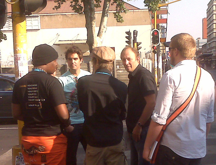
The research group was made up of five students from various Universities in South Africa and hosted at Arts on Main in the Johannesburg central business district.
The video below is the summary of the process and the work followed by the explanation in more detail
Convertible Cities 2010
Upon receiving the brief from Ivan the students studied the map of Johannesburg's CBD and decided, based on their proximity to Arts on Main and main life, that they would use choose a site within walking distance. Their intention being to choose a context that would have the energies required to fulfill a diverse mapping process.
 |
| Mapping Troye Street |

The Site
The students chose the route from Park Central Taxi Rank to Commissioner Street's BRT stop along Troye street as the group decided they would explore the connectivity of people in the CBD and resolve the brief from that standpoint.

The students chose the route from Park Central Taxi Rank to Commissioner Street's BRT stop along Troye street as the group decided they would explore the connectivity of people in the CBD and resolve the brief from that standpoint.

After a brief mapping exercise the group set to work, depicting the mapping process onto their framework that they had laid out before hand. The intention was to express their experience's through the CBD via the mapping and try convey what they felt and saw along the route.

Initial Concept
From these concept diagram the group proposed various interventions, agreeing that through connectivity they could increase the social cohesion of the urban city dwellers through incentive based game player scenarios at various points.
 |
| Concept Model - Social Interaction |
 |
| Concept Diagram - Incentive Nodes |


Giving the name to the system: SACCS - Campus of Life

Themes
The themes that governed the program were based on the notion of the contrast of the CBD contrasting to the rest of JHB as playground of pleasure versus a playground of survival with the CBD context being the location of the survival.
 |
| Playground of Pleasure |
 |
| Playground of Survival |

Through this analogy the group sought to 'convert the city' through breaking down the barriers of education by integrating the people of the city into a connected social group, who together can strive to a more educated and cohesive society themselves.
Program
The idea being that the people involved in their day to lives could participate at various nodes to work together at these points to gain credits in the form of either transport tokens, food tokens or access into beginner level course at various tertiary education systems in the CBD.

These points would be enhanced by the opening up of the ground floors of various building increasing the shop frontage that shops have and providing more opportunities through the movements of people.
 |
| FNB Faculty of Business |

These tertiary systems would be sponsored by the building who host the game players points on their ground level. i.e the FNB faculty of business, hosting a multi-player incentive point whereby users who take part and complete a series of business related questions together in a certain time would gain education credits to allow them access into the system.
Or the Pick 'n Pay transport node where users who clean the bus stop would be given food tokens and so on.

The methods of linking these points of interactivity would be done via cell phones, CCTV digital displays and other digital media. These would then supplement other campus activities such as the fashion schools who display their designs on ramps found on top of the BRT stops and displayed throughout the CBD via CCTV.
 |
| BRT Cat Walk with CCTV Link |
Other faculty points would be retrofits of existing buildings such as the Drill Hall, where the Arts Faculty would open up to the youth in the area and provide a space for expression of art and display student work.
 |
| Drill Hall Art Faculty |

Presentation
These interventions were marked out on key points on the framework, with the entire display creating a sensual display of the barriers and debris that a typical city dweller deals with on a daily basis.


 |
| Final Presentation |
Sunday, September 26, 2010
Conditions of Self-regulated Urbanity
Fragmentation - reduction of authority and the growth of self regulated initiatives
Frame Line – pronounced enclosure of the privatized territory
Concurrency - spatial implications of the various simultaneous states of existence
Hybridization- invention resulting from the fusion of multiple influences
Minimal Commons – a bit of coexistence where there’s nothing left to lose but a lot to add
Temporary Hierarchy - ability to take over particular spatial action for the limited time
Convertibles- potential of distorting limitations into a space of exchange
Expandability – capacity of hosting body to adapt to the uncoordinated external partitions
Shortcutting – fast break through congestion
Leftover - free space in between fulfilled desires
Para Source - plug inns to established energy network
Raw End - unintentional result of the most literal application of the basic building tools
Under Construction – continual delay due to undetermined rules of development
Saturday, September 25, 2010
Convertible City_Joburg
Ivan Kucina (Faculty of Architecture University of Belgrade, Serbia)
Dustin A. Tusnovics, Space Matters, Johannesburg
Convertible City is a research project that explores strategies to convert Joburg’s lines of division – its physical and mental boundaries - into places of positive social exchange. Urban boundaries could be considered a result of “disintegration” (social, functional, legal, economic, cultural, political, both historic and contemporary) in combination with the imperatives of rapid urban growth. These boundaries appear everywhere in the city at many levels, shapes and scales in both space and time. They could be seen to encompass the whole spectrum of urban phenomena: from informal to institutional, from temporal to eternal … This master class will propose that these boundaries signify the space, the line and the gap between different individuals, groups, territories and interests.
Taking a multiplicity of urban divisions as our starting point, this project aims to establish a provisional taxonomy of Joburg’s many states and expressions of ‘limit’ and ‘boundary’. The chosen situations will be scanned and mapped to expose the network of vibrant relations between social actors, their behaviors and the built environment. Using a series of diagrams to navigate through the mapped territory, each participant will then conceptualize a system of interventions that can act to convert boundaries into critically meaningful alternatives.
We aim to expose and capitalize upon a variety of complementary conversion concepts: the growth of bottom-up initiatives; the empowerment of concurrent states of existence; the fusion of multiplicity; the deviation of limitations; the ability to take the initiative for limited time; a bit of coexistence where there’s nothing left to lose but a lot to add; the most literal application of basic building tools; capacity building of a host body to adapt to uncoordinated external partitions; enlargement of the voids between fulfilled desires and continual delays due to undetermined construction processes…
Participants will create a comprehensive variety of outcomes at a diverse scale of strategic intent. From portable devices and installations to public building and the formation of new types of public space, this workshop will provide an intense bubble for experimentation and debate as we come to grips with Joburg’s many extremes of urban reality.
Guidelines for working on Convertible City
Saturday, 25 Sept
1. Atlas
- Collect data on the site
Research physical and mental division at the chosen site and observe activities of the spatial actors
- Make your story
Compare the collected data to identify the untapped potential of the division and the social, economic, technical factors that influence human activities.
Discover the uncharted attractors, inarticulate drivers of human activities, non-enlightened
forms of communication, unexpressed wishes and needs of society, or otherwise, the secrets
of the chosen site.
- Search the Internet:
Mobility - lines and their domain
Entertainment - restaurants, clubs, cafes, rafts, theaters, cinemas. ...
Trade - shops, kiosks, street trade...
Inactive - desolate, dangerous, closed, inaccessible...
Secret - unmarked, unobserved
Documented - texts about selected site
- Classify
Determined on the basis of taxonomy, sort and order data collected.
Spatial phenomena are divided into: places, routes, territory, attractors...
Activities of people divided according to: events, habits, relationships, meanings...
- Map
In the selected site map enter the data collected.
Apply different mapping techniques that correspond to certain classes of data.
Prepare photographs, drawings, plans, texts, diagrams, tables, movies
Sunday, 26 Sept
2. Scenario
- Brainstorm on the topic of urban division
Give attributes to the fragments of space.
Locate sources of energy.
Separate key terms that indicate the spatial phenomena.
Place the possible interventions.
- Formulate trends of attraction (assumptions about possible connections between the opposites)
Free transformation of data of the human activities
Create group profile of the people at the site.
Imagine different situations that would match the behavior of group profile.
- Create prototype
Connect the site, activities, group profile and trends in the unique concept.
Develop the concept through a series of reactions between site and group profile.
Test behavior of visitors in the established concept.
Brand (reduction of narrative material on the notation)
Monday, 27 Sept
3. Intervention
The concept of intervention on the site emerges through a series of working model deriving subsequently.
- Program diagram
Define your program elements within the site.
Each element is awarded by an abstract form.
Make the first working model that translates your program elements in 3D program diagram
- Spatial Diagram
Make the second working model to distinguish spatial relations obtained from previous models.
- Architecture diagram
Make the third working model to translate spatial makings and links into the language of architecture.
The appearance of the new design should surprise you.
You should ask yourself why is your product is different from existing ones?
Why anybody would love it?
What kind of emotional reaction is expected?
Which value is bringing to society?
Tuesday, 28 Sept
4. Presentation
Select and organize your project material and make:
Power Point slide show including 20x20sec slides in A3 landscape format ready for printing.
Upload compressed Power Point slide show with 300 words attached to the Convertible City blogspot.
Edit and print the cover page of Mail & Guardian newsmagazine to promote your intervention
Prepare 400 sec oral presentation.
Subscribe to:
Posts (Atom)